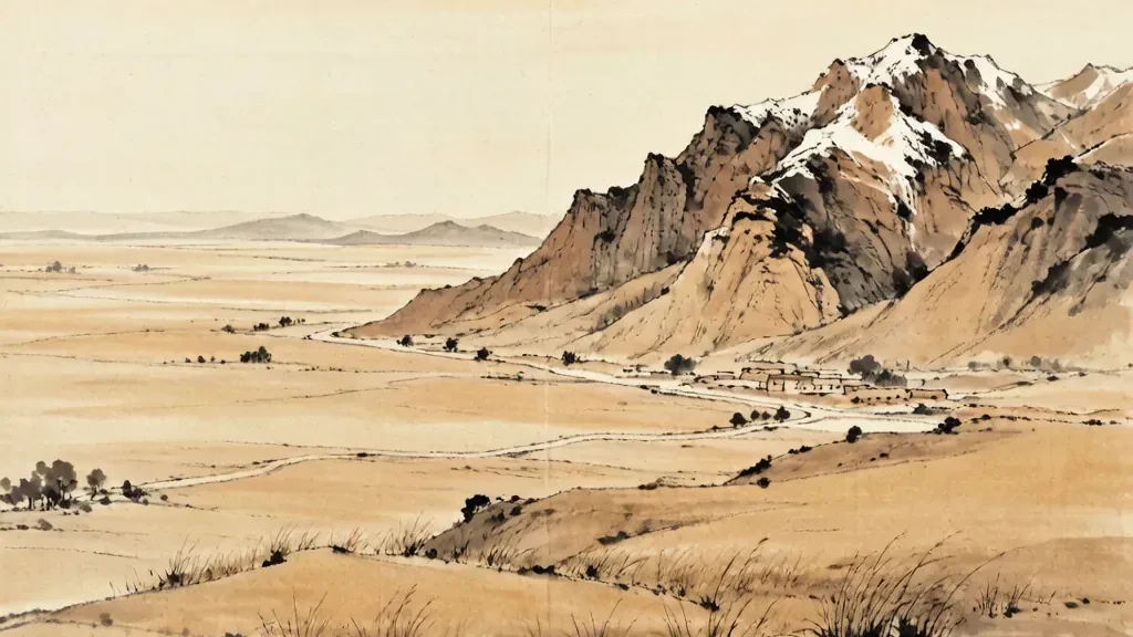
The Junggar Basin, known in Chinese as the Zhungar Pendi, is a vast intermontane basin in the northern part of the Xinjiang Uygur Autonomous Region, enclosed by the Altai Mountains to the north and the Tianshan range to the south, with the Dzungaria region stretching eastward toward the Gobi. Covering hundreds of thousands of square kilometers, it is the northern of Xinjiang's two great basins, the larger Tarim lying to its south across the Tianshan. Although it shares the arid character of Central Asia, the Junggar Basin is distinct for its relatively open northern gap, which lets moist air from the Arctic and the distant oceans penetrate farther than in the closed Tarim, giving it a steppe and semi-desert vegetation rather than pure sand sea. Rich in oil, gas, and coal, and historically the homeland of the Dzungar Mongols, the basin is today a crucial energy and agricultural zone at the crossroads of the Silk Road.
Location and Surrounding Ranges
The Junggar Basin sits between two mighty mountain systems: the Tianshan, whose snowy crest forms its southern wall and the border with the Tarim Basin, and the Altai, which rises to the north along the boundary with Mongolia and Russia. Unlike the Tarim, which is almost completely enclosed, the Junggar is open toward the northwest, a gap that allows weather systems to enter and moderate its climate.
This openness is the key to the basin's character. Air flowing in from the northwest brings more precipitation than the Tarim receives, supporting grass and scrub across much of the plain and a belt of forest on the flanks of the Altai. The result is a landscape that is arid but not lifeless, a mosaic of steppe, salt flats, and dunes rather than an unbroken desert.
The basin's floor is a gentle depression, its center occupied by the Gurbantunggut Desert, China's second-largest desert of shifting sand, while its margins grade from alluvial fans at the mountain feet into cultivated oases and grazing lands. The arrangement of range, fan, oasis, and dune repeats the classic geography of Central Asian basins.
The Gurbantunggut Desert
At the heart of the Junggar Basin lies the Gurbantunggut Desert, a mostly fixed and semi-fixed dune field whose vegetation-covered ridges contrast with the bare, mobile dunes of the Taklamakan to the south. Because the basin receives more moisture, many of its dunes are stabilized by shrubs and grasses, and the desert supports a surprising amount of wildlife in spring.
Vegetation such as saxaul and various halophytes grows on the sand and in the salt-affected lowlands, and after winter snowmelt the desert briefly greens, a phenomenon prized by botanists studying arid-land ecology. The desert is thus not the absolute barrier that the Taklamakan is, and caravans historically crossed its northern margin with care.
The name Gurbantunggut refers to the three prominent dunes or hills that early travelers used as landmarks, and the desert remains a focus of research into dune stabilization, water balance, and the effects of climate change on Central Asian drylands. Its relative mildness compared with neighboring deserts makes it a valuable natural laboratory.
Climate and the Northern Gap
The Junggar Basin has a temperate continental desert climate, with hot summers and very cold winters, the latter made severe by air flowing down from the Siberian north. Annual precipitation is low, mostly falling in summer as brief storms, yet it is higher than in the Tarim because of the northwestern opening that admits moist currents.
Snowfall in the surrounding mountains, especially the Altai, stores water that melts in spring to feed rivers and aquifers used for irrigation in the oases. This mountain-water system is the lifeline of the basin's agriculture, allowing crops to grow in an otherwise dry land through careful diversion of streams.
The contrast between the cold, snowy mountains and the warm, dry plain creates strong local winds, including the notorious winter storms that sweep across Dzungaria from the north. These winds, together with the basin's openness, give it a climate that is harsh but more variable and more productive than the sealed Tarim to the south.
Rivers, Oases, and Agriculture
Several rivers descend from the Tianshan and Altai into the basin, among them the Manas, the Urungu, and the Irtysh, which rises in the Altai and flows north out of the basin toward Siberia. These streams and their associated alluvial fans support oasis settlements where wheat, maize, sugar beet, and increasingly cotton and melons are grown.
The oases of the northern Silk Road, such as those around Shihezi and the provincial capital Urumqi on the southeastern margin, depend on this mountain water and on modern irrigation works, including reservoirs and canal networks built in the twentieth century. The basin is thus a patchwork of green farms set in a sea of steppe and sand.
Agriculture here has expanded greatly with improved water management, and the long summer daylight and warm temperatures make the land productive for certain crops, though always at the mercy of the limited and variable supply of meltwater. The balance between farming and the fragile desert margin is a constant concern.
Oil, Gas, and Mineral Wealth
Beneath the Junggar Basin lie substantial reserves of petroleum and natural gas, and the city of Karamay, whose very name means black oil, grew from a dusty frontier settlement into a major oil center after the discovery of large fields in the mid-twentieth century. The basin is one of the oldest and most productive oil regions of western China.
In addition to hydrocarbons, the basin and its surrounding mountains hold coal, gold, copper, and other minerals, and the adjacent Altai is famed for its metal deposits, historically including the rich ores that supplied steppe empires. This underground wealth explains much of the modern investment and population in an otherwise harsh land.
Energy extraction has transformed the basin's economy, linking it to national pipelines and to the industrial cities of the region, while also raising environmental questions about water use and land disturbance in a fragile dryland. The tension between resource development and ecological limits is acute here.
The Dzungar Mongols and History
The basin takes its Western name from the Dzungars, a federation of Oirat Mongol tribes who dominated the region in the seventeenth and early eighteenth centuries and built a powerful steppe empire stretching across Central Asia. The Dzungar Khanate controlled the trade routes and pastures of the basin and contested the Qing dynasty for supremacy in the northwest.
After a series of wars in the eighteenth century the Qing conquered the Dzungars and incorporated the basin firmly into the empire, resettling it with Han, Uygur, Kazakh, and Hui peoples and establishing the administrative framework that shapes the region today. The name Dzungaria survives as a geographic and historical label for the basin.
The legacy of the Dzungars is visible in place names, in the memory of the Silk Road khanates, and in the mixed ethnic makeup of modern Xinjiang. The basin was for centuries a meeting ground of Mongol, Turkic, and Chinese influences, a crossroads where empires clashed and caravans passed.
Silk Road Crossroads
The northern branch of the Silk Road ran through the Junggar Basin, linking China with the steppe and with Central Asia and beyond by a route that avoided the terrible Taklamakan. Caravans moved along the northern foot of the Tianshan, stopping at oasis towns that traded jade, horses, wool, and silk.
This northern corridor was strategic because it offered relatively reliable water and pasture compared with the southern desert road, and it connected the Chinese heartland with the cities of the Ili and the lands beyond. The basin thus sat on a commercial and military hinge between east and west.
Today the old logic of the corridor is reborn in modern transport and energy links crossing Xinjiang toward Central Asia and Europe, so that the Junggar Basin remains, as it has been for two thousand years, a passage and a meeting place rather than a dead end.
Wildlife and Steppe Ecology
Despite its aridity, the Junggar Basin supports a distinctive dryland ecology, including herds of gazelle on the steppe, the elusive wild Bactrian camel in remote dune areas, and a variety of raptors, foxes, and rodents adapted to the extremes of temperature. The Altai flanks add forest and river wildlife absent from the pure desert.
Spring brings a brief bloom of desert flowers and the activity of pollinators, while the snow-fed rivers sustain fish and the wetlands that form where water collects in lowlands. Conservation areas protect remnants of the original steppe and the rare species that depend on it.
The ecology is delicate because the boundary between steppe and desert shifts with climate and with human pressure such as overgrazing and fuel extraction. Studying how this boundary moves helps scientists understand dryland change across the whole of Central Asia.
Modern Cities and the Energy Corridor
The basin's southeastern edge hosts Urumqi, the regional capital, and nearby Shihezi, a planned city built by demobilized soldiers and settlers that became a model oasis of agriculture and industry. Karamay anchors the oil economy, while a network of smaller towns services farms, mines, and the transit corridors.
Modern infrastructure, from railways to pipelines, threads the basin and ties it to both the coast and the interior of Eurasia, fulfilling the ancient role of the region as a corridor while adding the logic of the energy age. The population is a blend of ethnic groups who together work the fields, wells, and roads.
As the Junggar Basin develops, it embodies the promise and the peril of arid-land growth: wealth from below ground and grain from irrigated fields, set against the constant need to protect a thin and easily damaged cover of vegetation. Its future will be written in how that balance is kept.
❓ Frequently Asked Questions
Where is the Junggar Basin?
It lies in northern Xinjiang, enclosed by the Tianshan to the south and the Altai to the north, with an open gap to the northwest toward Central Asia.
How does it differ from the Tarim Basin?
Unlike the enclosed Tarim, the Junggar is open to the northwest, admitting more moisture, so it has steppe and semi-desert rather than a pure sand sea.
What is the Gurbantunggut Desert?
It is the mostly vegetated, semi-fixed dune desert at the basin's center and the second-largest desert in China by area.
Why is the basin important economically?
It holds major oil, gas, and coal reserves, with Karamay as a key oil center, and its oases produce wheat, maize, cotton, and melons.
Who were the Dzungars?
They were a federation of Oirat Mongols who built a steppe empire in the basin before being conquered by the Qing dynasty in the eighteenth century.
What is the Silk Road connection?
The northern Silk Road ran through the basin, offering a watered route across Central Asia that avoided the severe Taklamakan Desert to the south.