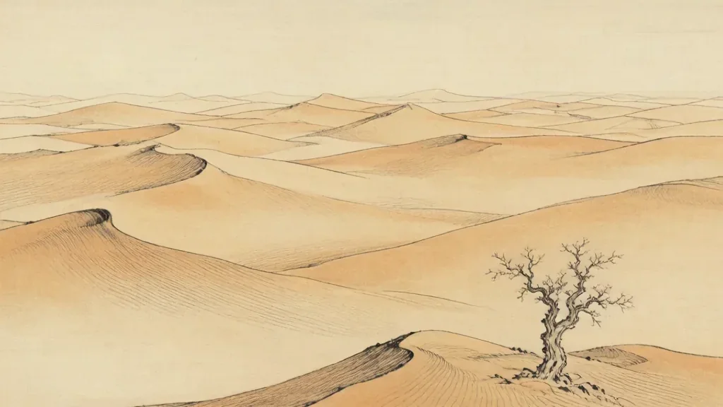
Deep in the heart of China's far west lies a desert so forbidding that travelers once named it the "Sea of Death." The Taklamakan — 塔克拉玛干 (Tǎkèlāmǎgān) — is the largest shifting-sand desert in China and one of the driest places on Earth. To cross it was, for centuries, an act of extraordinary courage, and the ruins of lost cities half-buried in its dunes are a testament to the caravans and kingdoms that once lived on its edges. Understanding the Taklamakan is essential to understanding the geography of Xinjiang and the long story of the Silk Road.
A Sea of Moving Sand
The Taklamakan occupies the center of the Tarim Basin in southern Xinjiang, a roughly oval bowl of land ringed by mountains. Covering an area of more than 300,000 square kilometers, it is second in size among China's deserts only to the combined sands of the northwest. What makes it especially hostile is not merely its dryness but the nature of its surface: enormous dunes, some hundreds of meters tall, that shift and migrate with the wind, swallowing roads, fields, and even the memories of settlements.
Almost no rain falls here. The mountains that enclose the basin — the Tian Shan to the north, the Kunlun to the south, and the Pamirs to the west — rob incoming weather of its moisture, leaving the interior parched. Rivers fed by mountain snowmelt drain toward the basin's center but vanish into the sand before reaching any sea, leaving only a vast, silent plain of dunes.
Why It Is Called the Sea of Death
The Uyghur name Tǎkèlāmǎgān is often glossed with grim poetry: "you can go in, but you will not come out." Whether or not that is the precise etymology, the sentiment captures the desert's reputation. Travelers who entered without water, guidance, and luck rarely returned, and the shifting dunes offered no landmarks to guide a lost party back to safety.
The danger was not only thirst. Sudden sandstorms could erase a trail in minutes, and the extreme temperature swings between blazing days and freezing nights tested even well-prepared expeditions. For the caravans of the Silk Road, the only sensible strategy was to skirt the desert's rim, hugging the foot of the mountains where rivers made life possible, rather than plunge into its heart.
Oasis Towns on the Desert's Edge
Because the interior was nearly impassable, human life in the Tarim Basin clustered around the oases where mountain rivers broke from the mountains and could be diverted for irrigation. Towns such as Kashgar, Khotan, Aksu, and Turpan grew at these green islands, each a node in the web of trade that stretched between China and the world to the west.
These oasis settlements became cultural crossroads where Chinese, Persian, Indian, and Central Asian influences met. They were places of markets and monasteries, of languages and religions in conversation, and their wealth depended entirely on the thin thread of water that the mountains sent down to them. Remove the rivers, and the oases — and the towns — would disappear back into the sand.
Lost Cities Beneath the Dunes
Some of those oasis civilizations did vanish. Buried by advancing dunes and preserved by the desert's dry air are the remains of ancient settlements such as Niya and Loulan, whose wooden houses, textiles, and documents survived for more than a thousand years because almost nothing rots in such aridity. Archaeologists have recovered manuscripts in several languages, fragments of clothing, and even the desiccated bodies of the desert's long-dead inhabitants.
These lost cities are a poignant reminder that the Taklamakan is not merely empty; it is a cemetery of civilizations, a place where the boundary between dwelling and abandonment is written in sand. Each discovery adds a sentence to the history of the Silk Road and of the many peoples who once called the basin home.
The Taklamakan and the Silk Road
No account of the desert is complete without the Silk Road, the network of trade routes that linked imperial China to Central Asia, Persia, and the Mediterranean. The Taklamakan sat squarely in the middle of that network, and caravans had to choose between a northern route and a southern route around its edges, each threading oasis to oasis. The desert was the great obstacle that gave the Silk Road its shape and its danger.
Goods moved both ways: silk, lacquer, and paper went west, while horses, jade, spices, and ideas came east. Buddhism, in particular, traveled into China along these routes, carried by monks who risked the crossing to bring their scriptures to new audiences. The Taklamakan was, paradoxically, both a barrier to exchange and the reason the exchange was so valuable.
Today: Taming and Protecting the Sands
In the modern era, the Taklamakan has been crossed at last. Highways now run along its rim and even cut straight across it, their surfaces defended by shelterbelts of trees and by engineering that holds back the moving dunes. These roads have transformed travel and trade in Xinjiang, turning a journey of weeks into one of hours.
Yet the desert remains a force to be reckoned with. China has invested heavily in controlling desertification, planting vegetation and building barriers to keep the sand from overwhelming farmland and towns. The Taklamakan is a reminder that even in an age of machines, the great landscapes of China still command respect, and that the "Sea of Death" has not entirely surrendered its mysteries.
Climate and the Rain Shadow
The Taklamakan's extreme aridity is the result of a powerful rain shadow. The Tian Shan to the north, the Kunlun to the south, and the Pamirs to the west intercept moisture from nearly every direction, leaving the enclosed Tarim Basin parched. Most precipitation falls instead as snow on the surrounding peaks. When that snow melts, rivers flow toward the center but usually vanish into sand long before reaching any sea. The result is a basin that receives almost no rain yet is ringed by just enough mountain water to sustain narrow ribbons of oasis life. This delicate balance of dryness and distant snowmelt is what has defined the desert for millennia.
Desertification and Modern Study
Today the Taklamakan is both a research site and a front line in China's fight against desertification. Scientists study its dunes, ancient lakebeds such as Lop Nor, and buried cities to reconstruct the climate history of Central Asia. At the same time, wind-borne sand threatens farmland and roads, so shelterbelts of trees and engineered barriers are maintained along the highways that cross the basin. Satellite imagery has revealed old river channels and the faint outlines of lost settlements beneath the sand. The desert remains a place where modern engineering meets one of the harshest environments on Earth, and where each discovery adds detail to the long story of the Silk Road.
❓ Frequently Asked Questions
📝 Chinese Vocabulary
塔克拉玛干 — : the Taklamakan Desert, often called the "Sea of Death."
沙漠 — : desert, a sandy wilderness.
绿洲 — : oasis, the fertile islands of life at the desert's edge.
沙丘 — : sand dune, the migrating hills of the desert.
丝绸之路 — : the Silk Road, the trade network that skirted the desert.
楼兰 — : Loulan; an ancient oasis kingdom whose ruins lie buried in the desert's eastern fringe.
罗布泊 — : Lop Nor; the now-dry salt lake that once lay east of the Taklamakan.
雅丹 — : yardang; wind-eroded ridges and grooves carved into the desert's clay and rock.
🎉 Fun Facts
- The Taklamakan is one of the driest and largest shifting-sand deserts on Earth, covering more than 300,000 square kilometers.
- Ancient buried cities such as Niya and Loulan survived for over a thousand years because the desert's dry air prevents decay.
- Buddhism entered China partly along the Silk Road routes that skirted the desert's edges.
- Summer temperatures in the Taklamakan can exceed 50 degrees Celsius, while winter nights may plunge below minus 20.
- Despite the deadly interior, the desert's rim supported a chain of oasis towns that became vital way stations of the Silk Road.
- Wind erosion has shaped dramatic 'yardang' landforms, ridges and grooves carved into the basin floor by centuries of blowing sand.