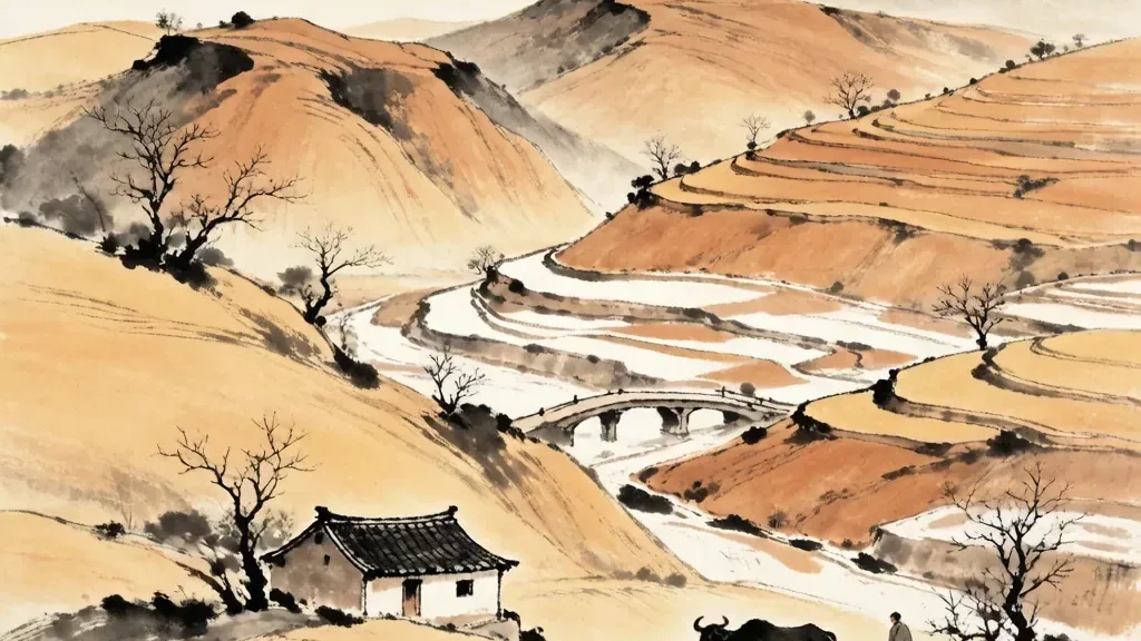
Covering a vast sweep of north-central China is a landscape the color of dust and history: the Loess Plateau — 黄土高原 (Huángtǔ Gāoyuán), the "yellow-earth highland." Built from wind-blown silt laid down over hundreds of thousands of years, this region is one of the most distinctive physical features of China and, remarkably, one of the birthplaces of Chinese farming. To understand the Loess Plateau is to understand where settled Chinese civilization took root and how people learned to live with both the generosity and the danger of the earth.
A Plateau Made of Wind-Blown Dust
Loess is a pale, fine, yellowish silt deposited by the wind. Over countless seasons, winds from the dry interior picked up fine particles from deserts to the northwest and dropped them across a broad region centered on the middle reaches of the Yellow River. Layer upon layer accumulated, in places hundreds of meters deep, until a whole plateau of soft, fertile earth had been built. The result is a landscape of rounded hills, deep gullies, and vertical cliffs of compacted dust.
What makes loess unusual is its structure. The silt particles are held together loosely, and the material is surprisingly easy to excavate, which allowed people to dig cave dwellings directly into the hillsides. At the same time, loess erodes rapidly when rain runs over it, carving the dramatic, deeply incised terrain that gives the plateau its sculpted look. The same softness that made life possible also made the land vulnerable.
The Cradle of Chinese Farming
Because the loess was both deep and rich in minerals, and because the climate allowed the growing of millet and later wheat, the plateau became one of the earliest centers of agriculture in China. Along the loess lands and the valleys of the Yellow River, some of the first Neolithic farming cultures of China flourished, domesticating grains and settling into villages long before the great dynasties arose.
This agricultural beginning helped anchor the emergence of Chinese civilization in the north. The early productivity of the loess soils supported growing populations, and the river valleys became corridors of communication and power. In a real sense, the yellow earth fed the yellow civilization, and the plateau's fertility is written into the very identity of the Chinese heartland.
Rivers, Erosion, and the Yellow River
The Loess Plateau is the source of much of the sediment that gives the Yellow River — 黄河 (Huáng Hé) — its name and its color. When rain falls on the loose earth, it carries enormous quantities of silt into the river, which then transports it downstream, sometimes depositing it in ways that caused both fertile floodplains and devastating floods. The river's temperament is, in large part, a product of the plateau it drains.
Historically, this relationship was violent. Floods and the shifting course of the river brought catastrophe to surrounding farmlands, and controlling the water became a central task of Chinese states for millennia. The plateau and the river together taught the people of the north hard lessons about engineering, cooperation, and the limits of human control over nature.
Life in the Yellow Earth
For centuries, the characteristic dwelling of the Loess Plateau was the cave house, or yaodong, carved into hillsides where the loess stood in stable banks. These homes stayed cool in summer and warm in winter, and entire villages grew into the earth rather than upon it. The practice is a brilliant adaptation to both the material of the land and the continental climate of the north.
Daily life on the plateau revolved around the agricultural year: planting millet and wheat, tending terraced fields, and managing scarce water. Folk songs, called "flower" songs in some areas, and local customs grew from this close, generations-long intimacy with the yellow earth. The plateau is not only a geological formation but a cultural one, shaped by the hands that worked it.
Environmental Challenge and Renewal
By the twentieth century, centuries of farming, deforestation, and erosion had badly degraded parts of the plateau. Gullies widened, topsoil washed away, and dust storms carried loess as far as the capital. The fragility of the wind-built earth became a national concern, and large programs were launched to stabilize the soil and restore vegetation.
In recent decades, terracing, tree-planting, and check dams have measurably reduced erosion and even turned some hillsides green again, while also cutting the amount of silt flowing into the Yellow River. The Loess Plateau has become a global example of landscape restoration, showing that a damaged earth can, with effort, be coaxed back toward health.
Why the Plateau Still Matters
The Loess Plateau remains central to China's geography and memory. It is where some of the deepest roots of Chinese agriculture lie, where the Yellow River gathers its defining sediment, and where a distinctive way of living with the land took shape. Even as modernization changes the countryside, the plateau's lessons — about fertility, fragility, and the need to tend the earth — are as relevant as ever.
To visit the region today is to see both the ancient and the renewed: cave homes beside new orchards, eroded gullies beside restored slopes. The yellow earth, patient and changeable, continues to teach the oldest lesson of Chinese geography — that human life and the land are one continuous story.
Loess Landforms: Yuan, Liang, and Ji
Wind-built loess does not form a single flat surface but a family of distinctive landforms shaped by water and gravity. The broad, flat-topped tablelands are called yuan; the long, rounded ridges running down slopes are liang; and the isolated conical hills are ji. Where gullies cut deep, these forms stand side by side, giving the plateau its stepped, sculpted appearance. Because loess is easily eroded yet also easy to dig, people have settled every kind of these forms, carving homes into stable hillsides and farming the tops. The same runoff that creates yuan, liang, and ji also carries away the soil, so the boundary between one form and the next is always shifting. Understanding these landforms is the key to understanding the plateau: they are at once the product of wind deposition, the stage for farming, and the source of its famous erosion problems.
From Dust Storm to Green Slope
For much of the twentieth century the Loess Plateau was a symbol of land gone wrong: stripped hills, choking dust storms, and rivers thick with silt. The turnaround began with patient, large-scale engineering, check dams that trapped sediment behind them, terraces that slowed runoff, and millions of trees and grasses planted on bare slopes. As vegetation returned, the soil held together better, springs reappeared, and the amount of sediment reaching the Yellow River fell sharply. Farmers gained from terraced orchards and steadier harvests, though the work also displaced some traditional practices. The plateau is now cited by scientists as one of the few places where severe degradation has been reversed at landscape scale. The lesson is not that nature alone can heal, but that sustained, well-planned effort by people can coax a damaged earth back toward productivity and green.
❓ Frequently Asked Questions
📝 Chinese Vocabulary
黄土高原 — : the Loess Plateau, the "yellow-earth highland."
黄土 — : loess, the wind-blown yellow earth.
窑洞 — : cave dwelling carved into loess hills.
黄河 — : the Yellow River, named for the loess silt it carries.
水土流失 — : soil erosion, the loss of earth to water.
谷子 — : millet, the drought-tolerant grain first farmed on the loess hills of the plateau.
信天游 — : sky-wandering, the folk songs of the Loess Plateau sung across its open valleys.
塬 — : yuan, a broad flat-topped loess tableland carved by erosion.
🎉 Fun Facts
- The Loess Plateau's silt is so fine and deep that people have lived in cave homes dug straight into the hillsides for centuries.
- Much of the sediment giving the Yellow River its name and color comes from erosion of the plateau.
- Restoration projects on the plateau have become a global model for reversing severe land degradation.
- The plateau's fine dust has blown as far east as the capital region during spring dust storms, a reminder of how mobile loess can be.
- Because the soil is so deep and soft, farmers on the plateau have long worked terraced fields that step down the hillsides to hold water and soil.
- Loess preserves things unusually well: ancient pottery and even the outlines of buried houses have survived for thousands of years in the dry, compact earth.