← Back to Geography
🏔️ Geography
Qinghai-Tibet Plateau (青藏高原) — Roof of the World
✍️ by xiaoyu luo
🗓️ Updated Jul 29, 2026
By Xiaoyu Land · 14 min read
The Qinghai-Tibet Plateau (青藏高原, Qīngzàng Gāoyuán), often called the 'Roof of the World' (世界屋脊, Shìjiè Wūjǐ), is the largest and highest plateau on Earth, covering approximately 2.5 million square kilometers — an area roughly the size of Western Europe — at an average elevation of over 4,500 meters (14,800 feet) above sea level. This vast, windswept landscape, straddling the Tibet Autonomous Region, Qinghai Province, and parts of Sichuan, Yunnan, and Gansu, was formed by one of the most dramatic geological events in Earth's history: the collision of the Indian tectonic plate with the Eurasian plate, which began approximately 55 million years ago and continues to this day, pushing the Himalayas and the Tibetan Plateau ever higher at a rate of about 5 millimeters per year. The plateau is not merely a geographical feature but a defining element of Asian civilization — it is the source of ten of Asia's major rivers, including the Yangtze, Yellow, Mekong, Ganges, Indus, and Brahmaputra, which together provide water to nearly half of humanity.
Geological Origins: The Birth of a Plateau
The geological story of the Qinghai-Tibet Plateau is one of the most dramatic chapters in Earth's history. Before the collision of the Indian and Eurasian plates, the ancient Tethys Ocean separated the two landmasses. As India — then an island continent — drifted northward at the remarkable speed (in geological terms) of 15-20 centimeters per year, the Tethys seafloor was forced beneath the Eurasian plate in a process called subduction. When the continents finally collided around 55 million years ago, the immense pressure crumpled the Earth's crust, folding marine sediments that had accumulated on the Tethys seafloor into the towering peaks of the Himalayas and uplifting the vast Tibetan Plateau behind them. Evidence of this marine origin is dramatically visible today: fossils of ancient sea creatures can be found at elevations exceeding 5,000 meters, and the summit of Mount Everest (8,848.86 meters) is composed of marine limestone containing fossils of ancient ocean organisms. The plateau's ongoing uplift has profound effects on global climate patterns — it deflects the jet stream, intensifies the Asian monsoon, and creates the rain shadow that forms the Gobi and Taklamakan deserts to its north. Scientists describe the plateau as the 'Third Pole' of the Earth, alongside the Arctic and Antarctic, because it contains the largest concentration of glacial ice outside the polar regions.
Life at the Roof of the World
Despite its harsh, high-altitude environment — where winter temperatures can plunge below -40°C (-40°F), oxygen levels are only 60% of those at sea level, and ultraviolet radiation is intense — the Qinghai-Tibet Plateau supports a remarkable diversity of life. The Tibetan antelope (藏羚羊, zàng língyáng), or chiru, with its extraordinarily fine wool that insulates against the bitter cold, undertakes one of the world's most dramatic migrations, traveling hundreds of kilometers to give birth in the remote Hoh Xil (可可西里) region. The wild yak (野牦牛, yě máoniú), an animal so well adapted to high altitudes that it cannot survive below 3,000 meters, roams the grasslands in herds that once numbered in the millions. The snow leopard (雪豹, xuě bào), one of the world's most elusive big cats, stalks the rocky crags in search of blue sheep and marmots. The plateau's wetlands serve as critical breeding grounds for the black-necked crane (黑颈鹤, hēi jǐng hè), the world's only alpine crane species and a sacred bird in Tibetan Buddhist tradition. Human habitation of the plateau dates back at least 21,000 years, with genetic studies revealing that Tibetan populations have evolved unique physiological adaptations to high altitude — including a gene variant inherited from Denisovans, an extinct hominin species, that allows more efficient oxygen utilization.
The Qinghai-Tibet Railway: An Engineering Marvel
The construction of the Qinghai-Tibet Railway (青藏铁路, Qīngzàng Tiělù), completed in 2006 and extended to Shigatse in 2014, represents one of the greatest engineering achievements of the 21st century. Stretching 1,956 kilometers from Xining, the capital of Qinghai Province, to Lhasa, the capital of Tibet, the railway climbs to an elevation of 5,072 meters at the Tanggula Pass — the highest railway point in the world. Engineers faced unprecedented challenges: permafrost covering over 550 kilometers of the route required innovative cooling systems to prevent the ground from thawing and destabilizing the tracks; the extreme altitude posed severe health risks to construction workers, with oxygen stations established every 10 kilometers; and the fragile alpine ecosystem demanded extraordinary environmental protection measures, including 33 wildlife underpasses designed specifically for Tibetan antelope migration. The railway has transformed Tibet's economy, reducing the cost of goods transported to the region by 75% and bringing over 100 million tourists to Lhasa since its opening. However, it has also raised concerns about cultural and environmental impacts, sparking ongoing debate about the balance between development and preservation in one of the world's most unique regions.
Spiritual Heart of Tibetan Buddhism
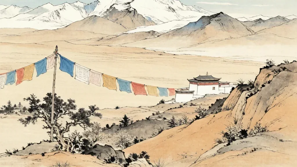
The Qinghai-Tibet Plateau is not merely a geographical and ecological wonder but the spiritual heartland of Tibetan Buddhism, a tradition that has shaped the plateau's culture, art, and daily life for over 1,300 years. The Potala Palace (布达拉宫) in Lhasa, a UNESCO World Heritage Site built in the 7th century by King Songtsen Gampo and expanded in the 17th century by the Fifth Dalai Lama, rises 13 stories and contains over 1,000 rooms, making it one of the world's most extraordinary architectural achievements at high altitude. Mount Kailash (冈仁波齐, Gāngrénbōqí), a 6,638-meter peak in the remote Ngari Prefecture of western Tibet, is considered sacred by four religions — Buddhism, Hinduism, Jainism, and the indigenous Bön tradition — and pilgrims undertake the arduous 52-kilometer circumambulation (kora) around its base, believing that a single circuit erases a lifetime of sin. The plateau is dotted with thousands of monasteries, from the vast scholarly complex of Sera Monastery near Lhasa, where monks engage in exuberant philosophical debates in tree-shaded courtyards, to remote hermitages perched on cliff faces accessible only by treacherous footpaths. The landscape itself is alive with spiritual meaning: prayer flags flutter on every mountain pass, mani stones carved with the mantra 'Om Mani Padme Hum' line pilgrimage routes, and the very mountains and lakes are believed to be the abodes of protective deities.
❓ Frequently Asked Questions
Q: What is the Qinghai-Tibet Plateau?
A: The Qinghai-Tibet Plateau (青藏高原) is the world's highest and largest plateau, covering about 2.5 million square kilometers with an average elevation of over 4,500 meters. Known as the 'Roof of the World' and the 'Third Pole,' it contains the largest ice reserves outside the Arctic and Antarctica.
Q: What major rivers originate from the Tibetan Plateau?
A: The Tibetan Plateau is the 'Asia Water Tower,' giving birth to 10 major rivers including the Yangtze, Yellow, Mekong, Salween, Indus, Ganges, Brahmaputra, and Yarlung Tsangpo. These rivers provide water to nearly 2 billion people across Asia.
Q: What is the railway to Tibet?
A: The Qinghai-Tibet Railway (青藏铁路) is the highest railway in the world, reaching 5,072 meters at Tanggula Pass. Completed in 2006, the 1,956-kilometer railway connects Xining to Lhasa, crossing permafrost regions and providing pressurized carriages for passengers.
Q: What is the significance of Mount Everest on the plateau?
A: Mount Everest (珠穆朗玛峰, Qomolangma), standing at 8,848.86 meters, is located on the border of Tibet and Nepal. The Tibetan name 'Qomolangma' means 'Holy Mother' or 'Goddess Mother of the World,' reflecting its deep spiritual significance.
Q: What plants and animals are unique to the plateau?
A: Specialists include the Tibetan antelope, wild yak, snow leopard, and black-necked crane, alongside cold-adapted grasses and cushion plants that survive intense ultraviolet light and thin air.
Q: How do people adapt to living at high altitude?
A: Tibetans have lived there for tens of thousands of years and carry gene variants, including one inherited from Denisovans, that let them use oxygen efficiently without the sickening thickening of blood that lowlanders experience.
Key Terms
青藏高原 (Qīngzàng Gāoyuán)
qīng zàng gāo yuán · 'Qinghai-Tibet Plateau' · 世界屋脊 (shìjiè wūjǐ, Roof of the World) · 第三极 (dì sān jí, Third Pole)
第三极 (dì sān jí)Third Pole, the plateau's nickname for holding the largest ice reserves outside the Arctic and Antarctic.
世界屋脊 (shì jiè wū jǐ)Roof of the World, the common English name for the Qinghai-Tibet Plateau.
雅鲁藏布江 (yǎ lǔ zàng bù jiāng)Yarlung Tsangpo, the river that becomes the Brahmaputra as it flows south off the plateau.
藏羚羊 (zàng líng yáng)Tibetan antelope, famed for its fine wool and its long migration across the plateau.
野牦牛 (yě máo niú)wild yak, a massive high-altitude grazer native to the plateau.
布达拉宫 (bù dá lā gōng)Potala Palace, the landmark of Lhasa and a symbol of Tibetan Buddhism.
冈仁波齐 (gāng rén bō qí)Mount Kailash, the sacred peak of western Tibet revered by several religions.
Fun Facts
- The Qinghai-Tibet Plateau contains over 46,000 glaciers covering an area of approximately 100,000 square kilometers — the largest concentration of ice outside the polar regions. These glaciers are the source of Asia's ten longest rivers, providing water for over 1.3 billion people.
- Tibetan people have lived at high altitudes for over 20,000 years and possess a unique variant of the EPAS1 gene, inherited from Denisovans, that prevents their blood from becoming too thick at high altitude — a condition that causes altitude sickness in lowland populations.
- The Qinghai-Tibet Railway required 2,045 bridges and 7 tunnels to cross the permafrost zone. The railway's construction consumed 15.8 billion yuan (approximately $2.3 billion USD at the time) and employed over 100,000 workers over five years.
- The plateau's uplift is so recent and ongoing that the Himalayas still rise a few millimeters each year as India pushes northward into Eurasia.
- Fossils of ocean creatures are found high on the plateau, proof that this roof of the world was once the floor of the ancient Tethys Sea.
- Because the plateau deflects the jet stream and strengthens the monsoon, its mere presence helps shape the climate of all of Asia.
Rivers and the Water Tower
The plateau is often called Asia's Water Tower, and with reason. From its glaciers and wetlands spring ten of the continent's great rivers, the Yangtze, Yellow, Mekong, Salween, Indus, Ganges, Brahmaputra, Yarlung Tsangpo, and others, that together deliver fresh water to nearly two billion people across a dozen countries. The mechanism is simple but vital: snow and ice melt through the warm months, releasing a steady flow that sustains downstream farms and cities even in dry seasons. When the glaciers shrink, that buffering supply weakens, raising fears for water security far beyond Tibet. The headwaters are therefore not just a scenic source but a strategic resource, and China has begun protecting the upper basins as ecological zones. The plateau's rivers link the roof of the world to the daily life of half a continent.
Climate Influence of the Plateau
Few landforms shape weather so widely as the Qinghai-Tibet Plateau. Its immense height forces the jet stream to split and bend, and it strengthens the summer monsoon by heating the air above it, which draws moisture-laden winds inland across South and East Asia. At the same time, the plateau creates a rain shadow to its north, helping form the dry Gobi and Taklamakan deserts. In winter its cold surface pumps air southward, deepening cold spells across the continent. Scientists study it as a driver of the Asian climate system, and even distant weather in Europe and North America feels indirect effects. As the plateau warms faster than the global average, its glaciers and snow cover are changing, which could alter monsoon timing and river flows for billions of people. The plateau is, in effect, a climate engine whose levers move weather far beyond its slopes.
Nomads and Highland Life
For centuries the plateau's vast grasslands supported nomadic herders of yaks, sheep, and goats, who moved with the seasons between winter and summer pastures. Tibetan, Mongol, and other highland peoples built their year around the animals, living in black tents or seasonal camps and trading wool, butter, and salt. This mobile life suited an environment too cold and thin for settled farming across most of the region. Religion shaped the rhythm too: pilgrimage circuits around sacred mountains, prayers at mani walls, and respect for the land as inhabited by spirits. In recent decades, many nomads have settled into towns or fenced pastures as part of development and grassland-protection programs, changing a way of life that had lasted millennia. The herders remain a living link between the plateau's people and its extreme, beautiful land.
Cities and Modern Change
Though often pictured as empty wilderness, the plateau holds growing towns and cities. Lhasa, the capital of Tibet, centers on the Potala Palace and a modern district of shops and universities; Xining, the capital of Qinghai, is a transport hub where the railway to Lhasa begins. Golmud and other settlements serve mining, salt lakes, and solar power. The Qinghai-Tibet Railway and new highways have cut travel time and brought goods, tourists, and migrants, lifting living standards but also straining water, energy, and fragile ecosystems. Urban growth brings hospitals, schools, and internet to places that were isolated a generation ago, yet also raises hard questions about cultural preservation and environmental limits. The plateau today is a place where ancient highland traditions and rapid modern development meet at the top of the world.